
Drone Services
Survey & Mapping
Site data from day one
A decision is only as good as the site data behind it.
Early-stage planning and civil design decisions are often made on outdated, incomplete or expensive-to-obtain site data.
We deliver fast, accurate aerial survey data that gives you a reliable spatial foundation from day one.
‘Waiting weeks for a survey crew delays every decision that depends on it.’
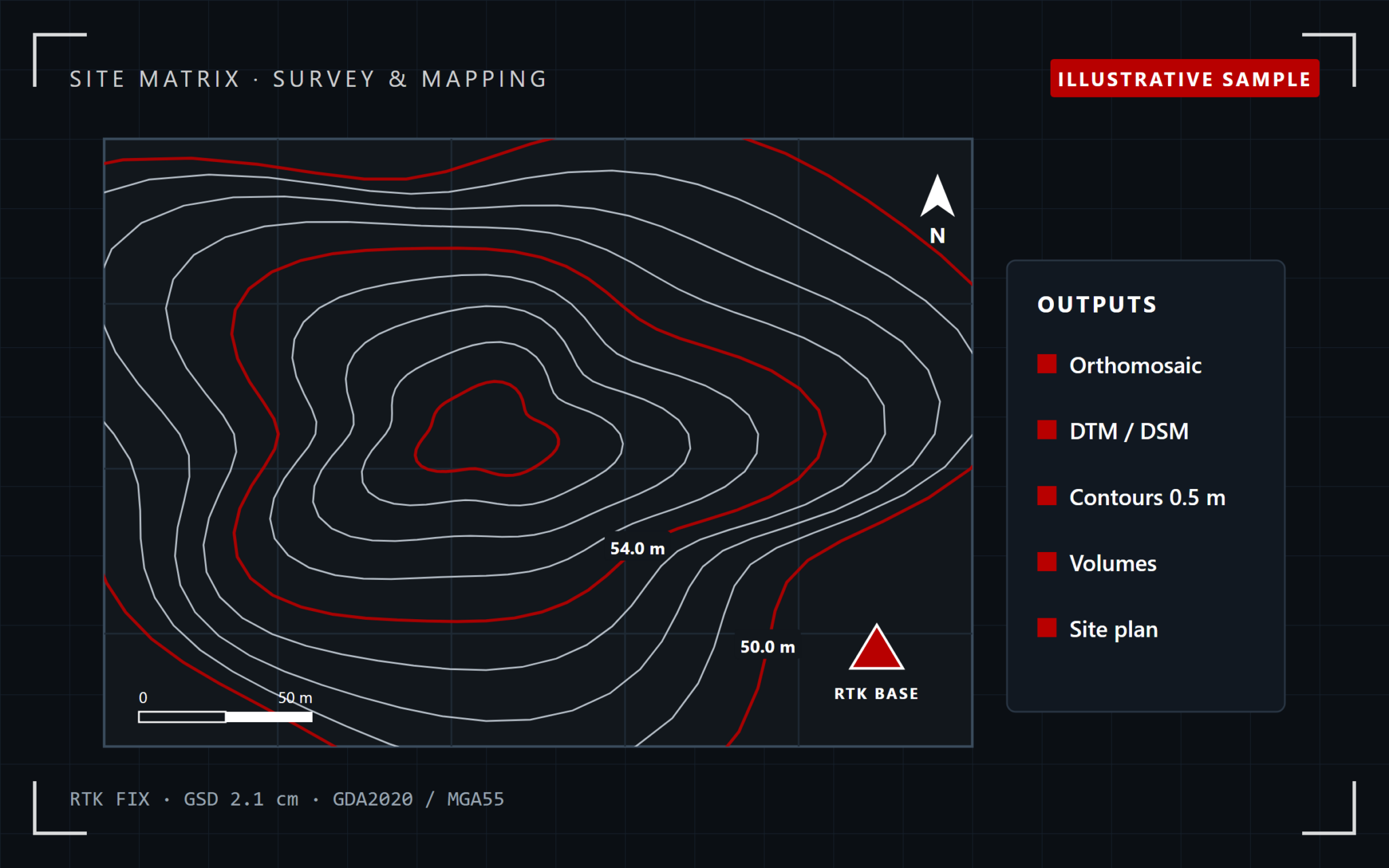
The problem: data you don’t have yet
Outdated, incomplete, or weeks away.
Outdated topographic data, a survey crew booked weeks out, or spatial information that simply doesn’t exist yet — all of it delays the decisions that depend on it.
Aerial survey closes that gap
RTK-positioned capture for survey-grade results — without the wait.
How we solve it
Fly. Process. Deliver.
Fly
Full site coverage,
RTK-positioned
Survey-grade GPS positioning for the accuracy the deliverable needs
Process
Raw capture into
usable survey data
Orthomosaics, digital terrain and surface models
Deliver
In the format your
design software uses
Contours, DTM/DSM, or a site establishment plan
What we deliver
The spatial foundation for your project
What the data shows
Every output has a job
| Deliverable | What it’s used for |
|---|---|
| Orthomosaic | A geo-referenced, accurate image of the whole site — the base layer everything else sits on |
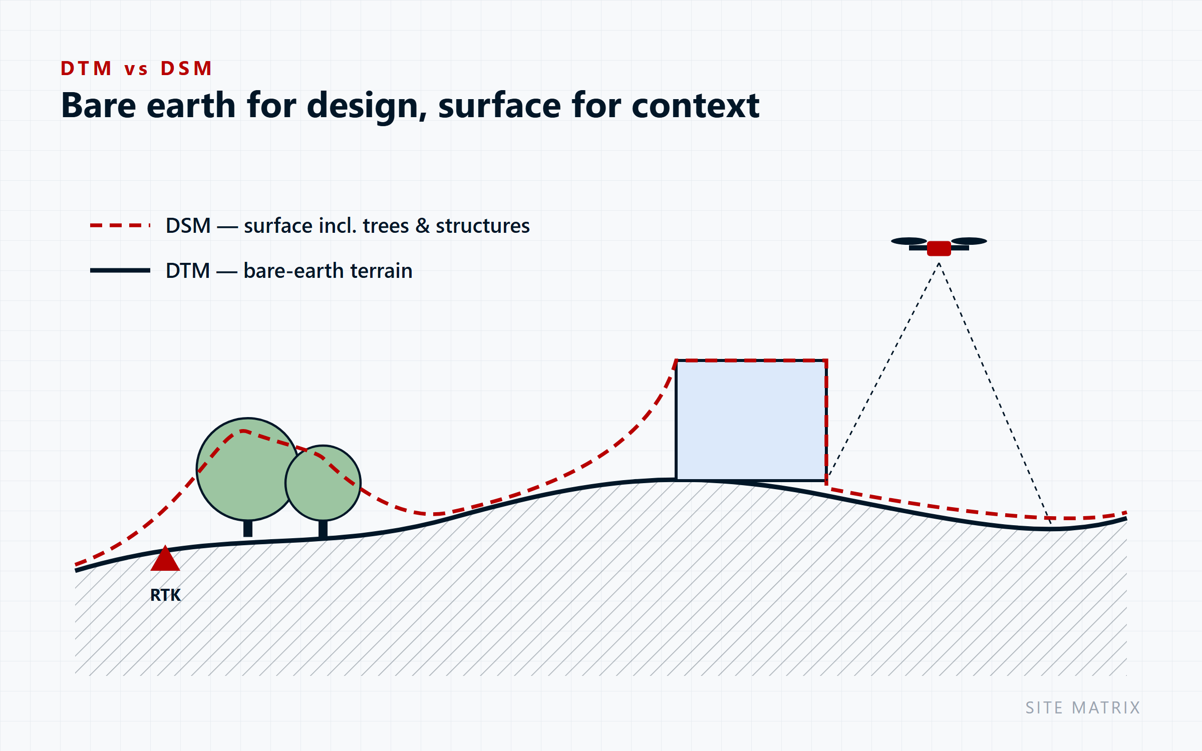
| DTM (Digital Terrain Model) | Bare-earth elevation data — the foundation for drainage and earthworks design |
| DSM (Digital Surface Model) | Elevation including vegetation and structures — useful for site context and clearance checks |
| Contour lines | Derived directly from the terrain model — standard input for civil design software |
Why it matters
Fast, accurate, repeatable
Fast
Site-scale spatial data without waiting weeks on a traditional survey crew.
Accurate
RTK-enabled positioning for survey-grade results.
A genuine starting point
Planning submissions and civil design input ready from day one.
Repeatable
The same site can be re-flown to track change over time.
Who we work with
For planning, design and earthworks
Developers & planning consultants
Civil & drainage engineers
Earthworks contractors
Get the site data your next decision depends on — without the survey-crew wait.
Your questions answered
Frequently Asked Questions
How accurate is drone survey data?
We use RTK-enabled positioning for survey-grade results; achievable accuracy depends on setup and site, and is confirmed with you at scoping.
What formats do you deliver?
Orthomosaics, DTM/DSM, contours and site plans in the formats your design software uses.
Do you need access to my property or site?
Not necessarily — inspections work from the air or agreed setback distances. Any site entry requirements (e.g. restricted airspace, fenced sites) are coordinated in advance during scoping.
What happens if it’s too windy or rainy to fly?
We reschedule at no cost. Flights only go ahead within CASA-compliant weather and wind-speed limits, to protect both safety and data quality.
Who owns the data and imagery?
You do. All captured data, imagery and reports become your property on delivery; we retain a copy for our own records only.
Are you insured and licensed?
Yes — all flights are conducted under our CASA ReOC (9692) and a current RePL, with commercial liability insurance in place.