
Drone Services
Reality Capture
Digital twins & BIM
The drawing says one thing. The building says another.
Design, facilities management and renovation decisions are routinely made on outdated drawings or incomplete site knowledge — leading to clashes, rework and costly on-site surprises.
We give you an accurate, current digital representation of what’s actually there.
‘A clash found on a model costs nothing. The same clash on site costs a delay.’
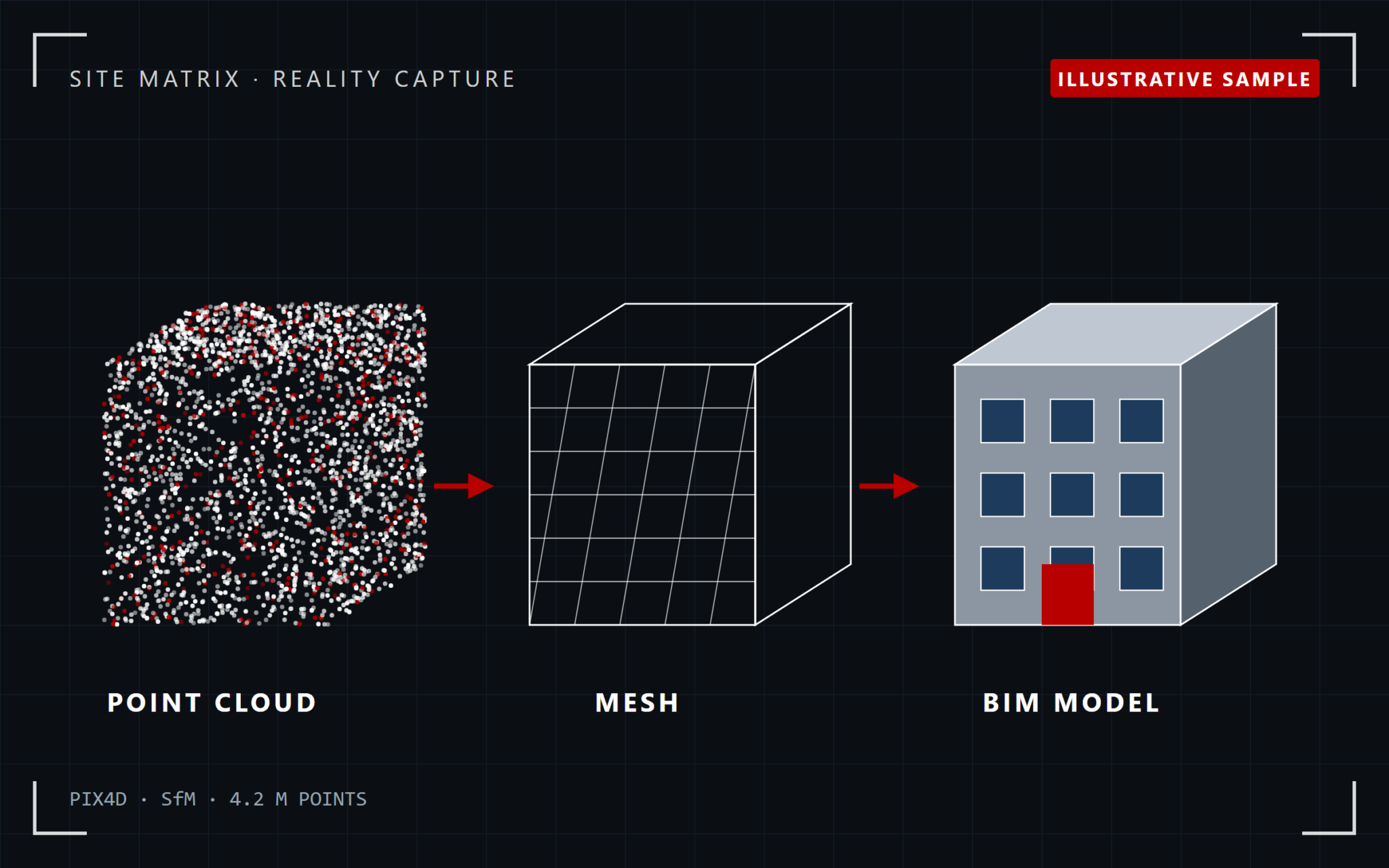
The problem: drawings go out of date
Every informal change since, missing.
Most drawings predate every informal change made on site since they were issued. Design, FM and renovation decisions made on them are assumptions, not measurements.
An accurate model closes that gap
Decisions from here are based on what’s actually there — not what the drawing says should be.
How we solve it
Capture. Process. Deliver.
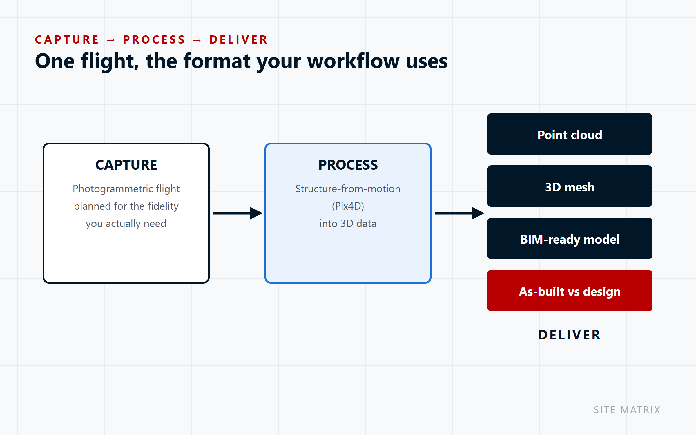
Capture
A comprehensive
photogrammetric flight
Full coverage planned for the model fidelity the project actually needs
Process
Structure-from-motion
processing (Pix4D, DJI Terra)
Into a point cloud, mesh or BIM-ready model
Deliver
In the format your
workflow uses
Point cloud, mesh, or converted BIM elements
What we deliver
From capture to coordinated model
What the data shows
Choose the output that fits the job
| Output | What it’s used for |
|---|---|
| Point cloud | Raw, dimensionally accurate 3D data — the foundation for everything else, often enough on its own for measurement and clash checks |
| 3D mesh | A visual, textured model — useful for stakeholder walkthroughs and design presentation |
| BIM-ready conversion | Point cloud data converted into elements usable directly in Revit or equivalent design software |
| As-built comparison | The captured model measured against the original design — flags exactly where reality has diverged |
Why it matters
Design against reality, not assumptions
Accurate, not assumed
Decisions based on what’s actually there, not what the drawing says should be.
Catches clashes early
A clash found on a model costs nothing; the same clash on site costs a delay.
A genuine FM baseline
An accurate starting model makes every future condition comparison meaningful.
Feeds other services
The same capture underpins Construction Monitoring and NDT dimensional verification.
Who we work with
For the people who design, build and manage
Architects & designers
Facilities managers
Renovation & fit-out contractors
Start your next design, fit-out or FM program from a model you can trust.
Your questions answered
Frequently Asked Questions
What formats do you deliver?
Point cloud, textured mesh or BIM-ready elements — we confirm formats and accuracy requirements with you at scoping.
Can you compare our as-built against the design model?
Yes. The captured model is measured against the original design to flag exactly where reality has diverged.
Do you need access to my property or site?
Not necessarily — inspections work from the air or agreed setback distances. Any site entry requirements (e.g. restricted airspace, fenced sites) are coordinated in advance during scoping.
Who owns the data and imagery?
You do. All captured data, imagery and reports become your property on delivery; we retain a copy for our own records only.
Are you insured and licensed?
Yes — all flights are conducted under our CASA ReOC (9692) and a current RePL, with commercial liability insurance in place.
Explore more
Related Drone Services
Pairs well with: → NDT — Access & Verification · → Construction Monitoring