
Drone Services
Insurance Assessment & Works Validation
Evidence, not opinion
An independent record for every claim and sign-off.
Storm damage claims, disputed scopes and works sign-off all come down to the same question: what was actually there, and when?
We give insurers, owners and builders an independent, timestamped visual record — before, after, and once the work is done.
‘When the evidence is timestamped, the argument is shorter.’
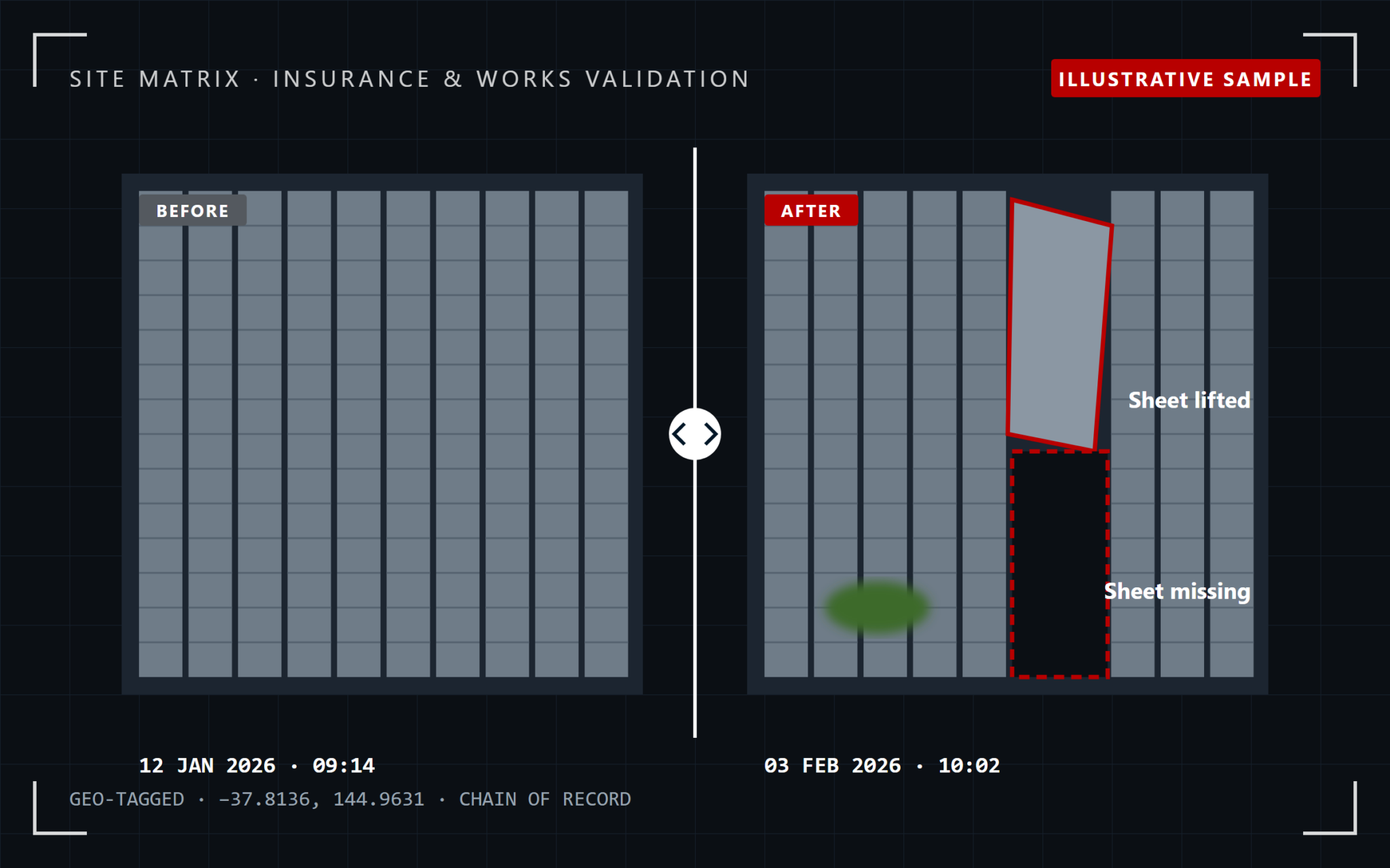
The problem: whose word do you take?
Claims stall without evidence.
Damaged roofs are dangerous to access, and after a storm everyone needs answers at once. Without an independent, dated record, claims and scopes get disputed and sign-off drags on.
Independent aerial evidence closes that gap
Geo-located, timestamped imagery captured safely from the air — with no one on a damaged roof.
How we solve it
Record. Compare. Validate.
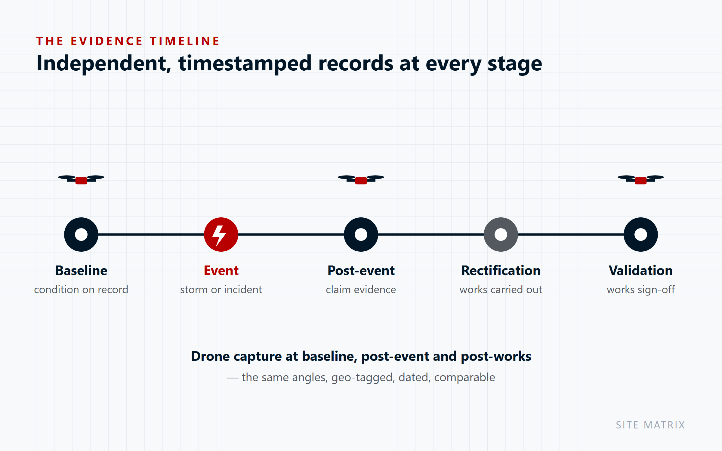
Record
Capture the condition
on record
A baseline before works or storm season — or straight after an event
Compare
Same angles,
geo-tagged and dated
Before and after imagery that’s directly comparable
Validate
Post-works
verification
Independent confirmation that rectification matches the agreed scope
What we deliver
Evidence at every stage
What the data shows
The right record for each stage
| Record | What it’s used for |
|---|---|
| Baseline capture | Condition on record before works or storm season — the reference for any future claim |
| Post-event assessment | Located, imaged evidence of damage to support the claim and scope |
| Scope verification | An independent view when the extent of damage or works is disputed |
| Post-works validation | Confirmation that rectification is complete and matches the agreed scope |
Why it matters
Faster claims, fewer disputes
Independent
A third-party record, not the contractor’s or claimant’s own photos.
Timestamped & geo-located
A defensible record for insurance, warranty and dispute contexts.
No one on a damaged roof
Safe capture of unsafe structures after an event.
Complete, not sampled
The whole roof and facade, not just the areas someone could reach.
Who we work with
For everyone involved in the claim
Insurers & loss adjusters
Asset owners & strata managers
Builders & remediation contractors
Put a baseline on record before storm season — it’s the evidence you’ll want later.
Your questions answered
Frequently Asked Questions
How quickly can you attend after a storm?
We prioritise post-event assessments and will confirm timing when you call, subject to safe flying conditions.
Is the imagery suitable for insurance claims?
Yes — every image is geo-located and timestamped, and reported as a located, imaged record.
What if the inspection finds something urgent?
Any safety-critical or urgent finding is flagged to you immediately, ahead of the full report.
Who owns the data and imagery?
You do. All captured data, imagery and reports become your property on delivery; we retain a copy for our own records only.
Are you insured and licensed?
Yes — all flights are conducted under our CASA ReOC (9692) and a current RePL, with commercial liability insurance in place.
Explore more
Related Drone Services
Pairs well with: → Drone Inspections · → Thermography — Roofs & Facades